Drawing of Missisippi river, 1944
Harold Fisk
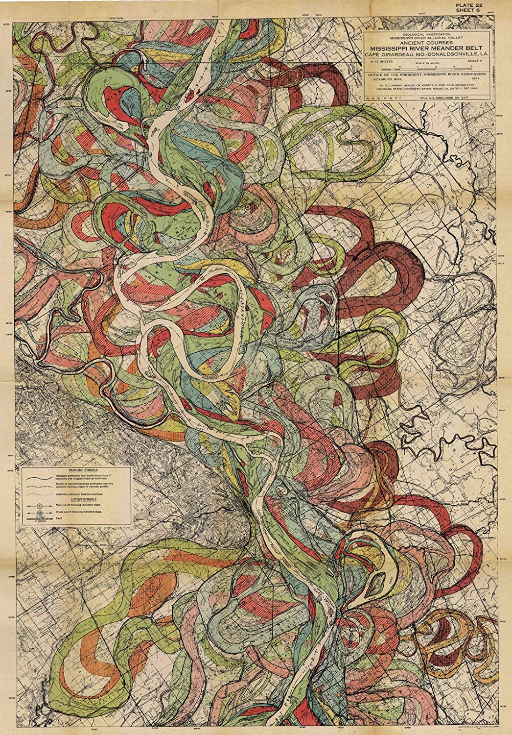
"This eye-catching map, drawn by Harold Fisk — a geologist and cartographer working for the US Army Corps of Engineers — trace the ever-shifting banks of the Mississippi river from southern Illinois to southern Louisiana. Created to illustrate a rather dry government report on “the nature and origin of the Alluvial Valley of the Lower Mississippi River”, these cartographic marvels give even the untrained a very good sense of what the report calls the “stages in the development” and the present “behavior” of the river system. In plain English: Fisk dreamed up a captivating, colorful, visually succinct way of representing the Mississippi’s fluctuations through both space and time."